Web Development and Mapping Services.
Create Custom Maps for
Groups, Local Charities and Interactive Community Mapping.
Businesses too.
- Community Mapping. Local charities or groups can create a custom interactive map of Graveyards, War Casualties or perhaps Environmental Mapping: an Orchard Map? Or a database of rare trees in a woodland or other plants?
- Interactive Map Maker: build your website with information as normal and I'll help you integrate that data with a map for easier interpretation and interaction.
- Bring your knowledge to life by adding the spatial element. And map changes over time.
- Use Google Maps, Open Street Map (free data you can edit) or Ordnance Survey mapping.
- Potential for far greater accuracy and map quality than typical google map developers would provide.
- Easy to use for non map experts, no expensive equipment. No complex map software to maintain.
- Low cost solution. One-off price similar to a normal website - inexpensive hosting options of around £40 per annum
Freelance Web Map Design And Development Services
Most of my mapping clients prefer to keep their map projects secret. So I'm unable to point you to many of my projects. I support products for the web map data supplier BlueSky International.
Additional web mapping services: GIS Analysis and Development - e.g. QGIS, Ordnance Survey OpenSpace, MapBox, PostGIS Spatial Databases, Google Maps, OpenLayers API etc.
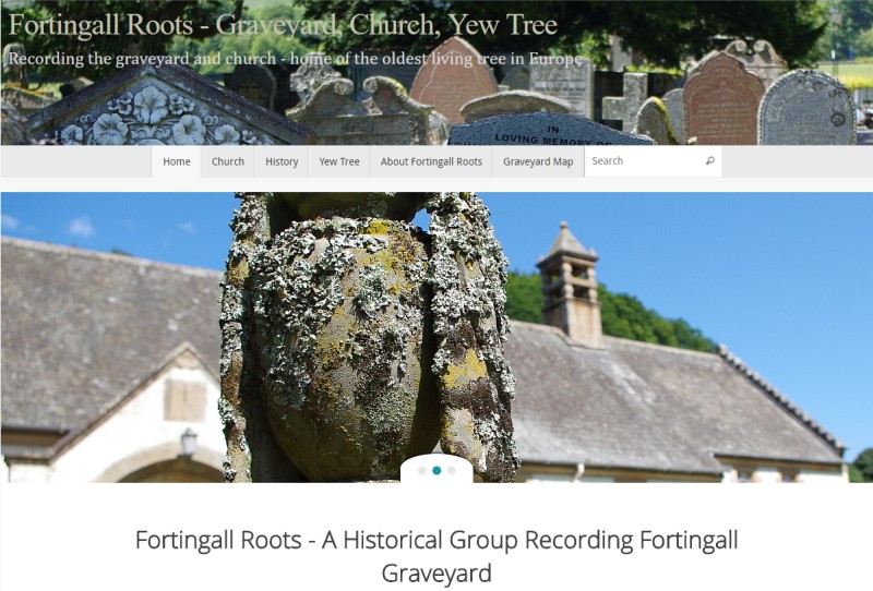
Archaeology and Graveyard Interactive Map Design
Volunteer Archaeology Map is a prototype system built to demonstrate a range of web mapping features. As part of ongoing development of Fortingall Roots Map Project.
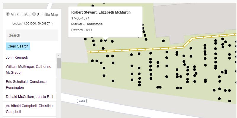
Display of map markers. Allowing very accurate mapping way beyond the simplistic Google Maps.
You will be able to edit the underlying map e.g. add a new path Google or Ordnance Survey won't ever map.
Markers added by the custom editing tools shown below.
War Memorial Community Mapping Project
A project to map the soldiers, sailors and airmen listed on the Bo'ness War Memorial. This map shows where the fallen were buried and also where they were commemorated. Often individuals are mentioned on other graves or plaques in gardens of remembrance or in churches.
Additionally, the system maps where they were wounded or killed in action with accuracy indication. Many mapping systems use an "X marks the spot" even when there is doubt over the actual accuracy of the position.
Additionally, the system has an interactive timeline feature. Viewers can play a month by month casualty map of World War 1.
This project is in development. More data will arrive soon. (Written May 2018 - content expected throughout the winter of 2018/2019).
Visit the Bo'ness War Memorial Website to watch development.
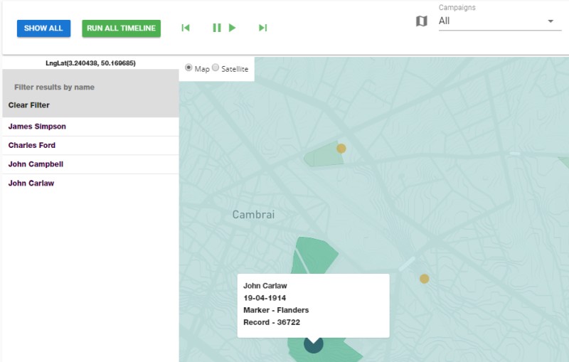
With a few minutes training users can enter specific information for Map markers - including time and date.
These link to the main website holding detailed information on the marker.
And permit visitors to watch an Interactive Timeline of Events. In this case Great War Casualties.
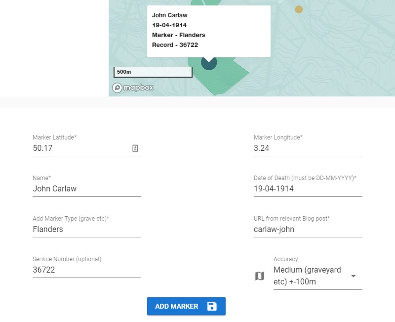
In this example, a military focused map has Date of Death, Service Number etc.
Accuracy is used here to create different sized circles indicating how sure the user is of the accuracy of the marker.
If more accurate information is determined (perhaps by GPS or field trip) the accuracy size can be reduced.
Markers can easily be moved.
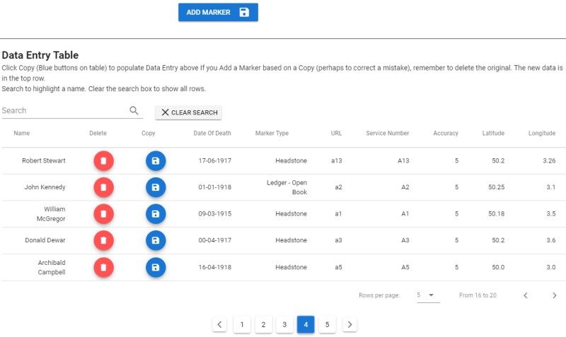
Search for, copy and delete database rows from your browser. No complex database entry or maintenance.
Build Your Own Community Interactive Map Maker
Create your own custom map of your community project. Perhaps you have an old graveyard project; an ancient orchard; an archaeological site; (note that archaeological digs need more precise 3D type mapping); or an historic site which needs a lot of data but has a spatial element?
As a Freelance Web Map Developer I can keep costs low. So get in touch with the links below.
you could have a custom map
Based in Bo'ness, Falkirk, Central Scotland.
Serving customers throughout the UK.
Geographic Information Systems
Web Map Designer
MODx - Content Management System
Django Web Development Framework
Wordpress Websites
Strapi CMS
Vue Frontend Framework
MapBox Mapping
QGIS
OpenLayers Maps
Ordnance Survey Maps
Epic Hosting by Opalstack - for power users

eCommerce by Foxycart
